Desert Hillside Residence
Traditional Site Plan Visualization
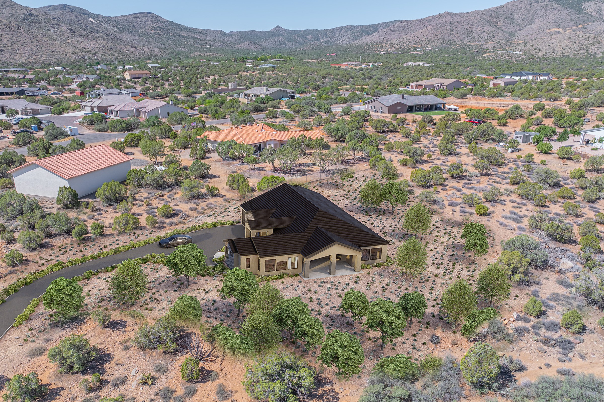
Drone photograph of a single-family residence on an arid desert hillside lot with sparse vegetation, surrounded by scattered neighboring homes and mountains.
For the “Desert Hillside Residence” project, our client sought a striking visual representation of their single-family home nestled on an arid hillside. The aim was to capture the essence of the residence while showcasing its harmonious integration with the surrounding desert landscape. With sparse vegetation and neighboring homes scattered throughout the area, the client needed a rendering that would not only highlight the architectural features but also convey the unique charm of desert living.
Our approach to this project was centered around creating a photorealistic rendering that emphasized the interplay of light and shadow on the residence’s facade. We meticulously selected materials that echoed the natural tones of the desert, ensuring that the home appeared as if it was a seamless extension of its environment. By utilizing advanced software such as 3ds Max and V-Ray, we were able to achieve stunning realism in textures and lighting. The late afternoon sun cast warm hues across the structure, accentuating its architectural details while creating a captivating atmosphere.
The final result was a breathtaking drone photograph-style rendering that not only met but exceeded our client’s expectations. This visualization played a crucial role in securing planning approval, as it provided stakeholders with a clear understanding of how the residence would coexist with its surroundings. Additionally, the high-quality imagery was instrumental in the client’s marketing efforts, effectively attracting potential buyers and investors by showcasing the property’s unique appeal. Ultimately, our collaboration on the “Desert Hillside Residence” demonstrated our commitment to delivering exceptional architectural visualizations that resonate with both clients and their target audiences.
Project Overview
When land development company reached out about Desert Hillside Residence, the scope was intentionally tight. One render. No gallery. Just the strongest possible version of this master plan design.
Drone photograph of a single-family residence on an arid desert hillside lot with sparse vegetation, surrounded by scattered neighboring homes and mountains.
The Result
Delivered within 1-2 weeks, the render slotted straight into the land development company’s pitch deck and has been their lead visual for the project.
If this is the kind of quality you’re after, start a conversation with us. Or explore the full portfolio.


