Casey Residential Street
Mixed Residential Community Visualization
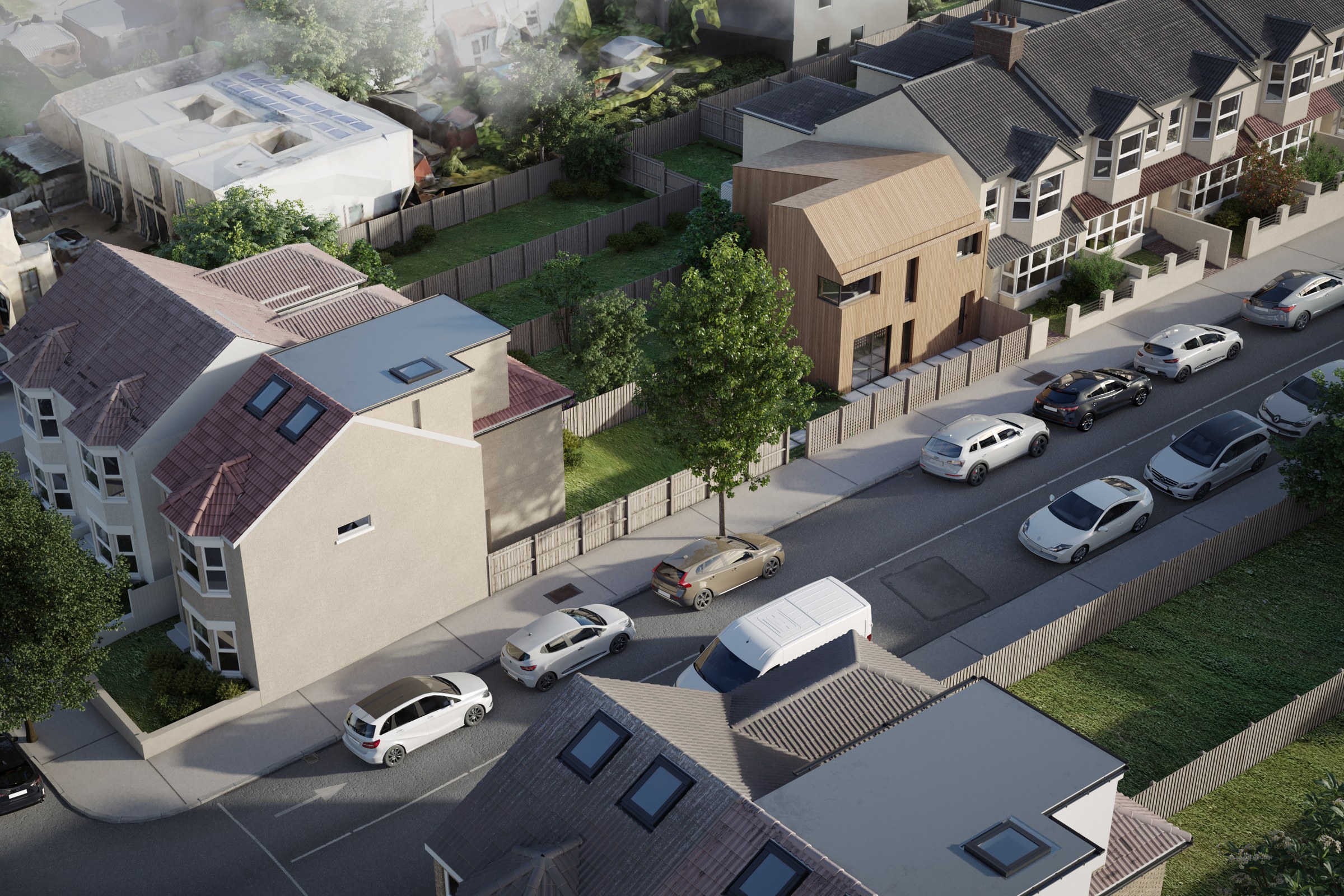
Aerial render of a residential street with mixed housing styles including a modern timber-clad home among traditional pitched-roof houses, parked cars, and morning mist.
For the “Casey Residential Street” project, our client sought a captivating aerial render that would showcase a diverse array of housing styles within a picturesque residential setting. The goal was to highlight a modern timber-clad home nestled among traditional pitched-roof houses, capturing the essence of community and architectural harmony. This visualization was crucial for the client, as it aimed to attract potential buyers and secure planning approvals by illustrating the unique character of the neighborhood.
Our approach to this rendering was centered around creating a sense of depth and realism that would resonate with viewers. We meticulously composed the scene to emphasize the juxtaposition of modern and traditional architecture, ensuring that each home was distinct yet complementary. The morning mist added an ethereal quality, enhancing the overall atmosphere and inviting viewers to imagine themselves in this serene environment. By focusing on the interplay of light and shadow, we brought the scene to life, making it not just a visual representation but an experience.
In terms of technical execution, we utilized advanced software such as 3ds Max and V-Ray to achieve photorealistic results. We paid careful attention to the materials, opting for realistic textures that reflected the properties of timber and traditional roofing. The lighting was designed to mimic the soft, diffused glow of early morning, creating a warm and inviting ambiance. This attention to detail ensured that the render not only looked stunning but also conveyed the intended mood of the neighborhood.
The final result exceeded our client’s expectations, significantly aiding in their marketing efforts and investor pitches. The aerial render effectively showcased the potential of the development, leading to successful planning approvals and generating considerable interest from prospective buyers. Our work on “Casey Residential Street” exemplifies our commitment to delivering high-quality architectural visualizations that drive results for our clients.
Project Overview
Casey Residential Street was a quick-turn engagement. The master plan developer had a design they were proud of and needed it visualized — no extras, just one precise, photorealistic render.
Aerial render of a residential street with mixed housing styles including a modern timber-clad home among traditional pitched-roof houses, parked cars, and morning mist.
The Result
The final output landed within 1-2 weeks. Clean, high-resolution, ready for print and screen. It’s been the visual backbone of this project’s public-facing materials.
Working on something similar? Let’s talk about your project — or browse more of our work.


