Blue Commercial Building
Contemporary Site Plan Visualization
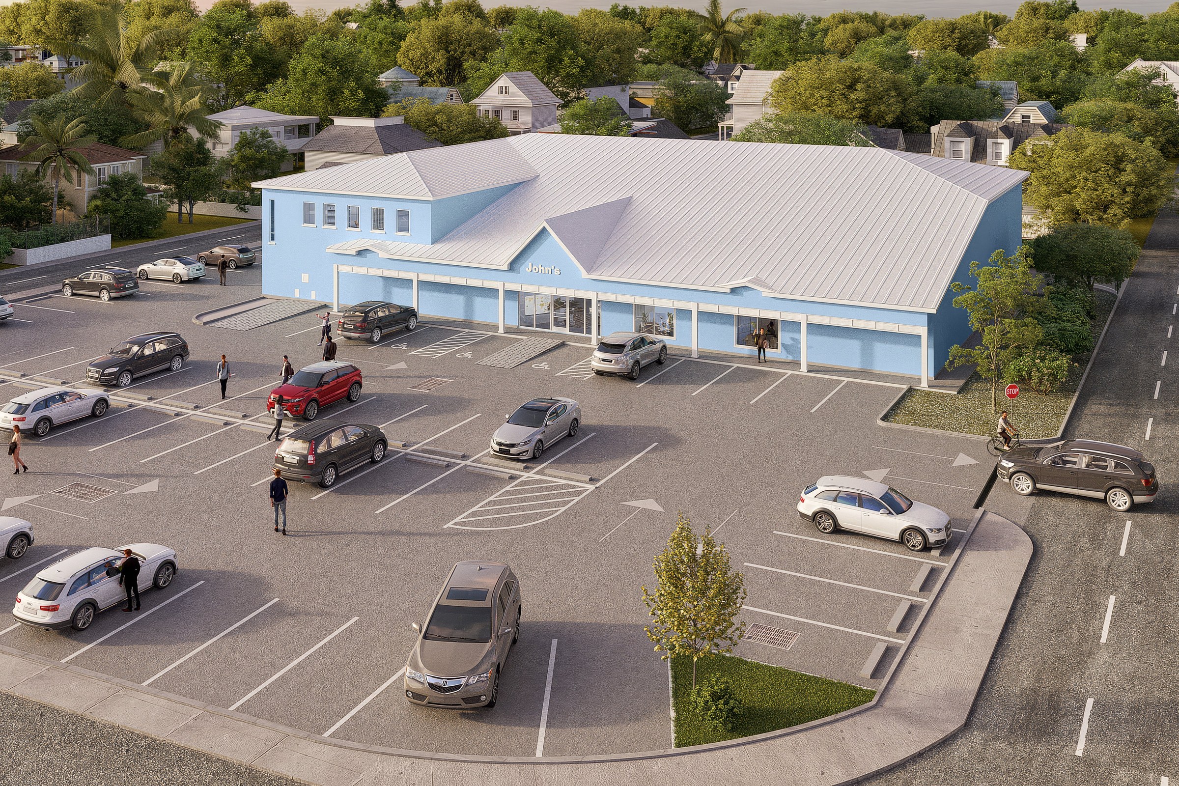
Aerial render of a large blue and white commercial or community building with a hip roof, surrounding parking lot, and nearby residential streets.
For the “Blue Commercial Building” project, our client sought a striking aerial render that would effectively showcase their large blue and white commercial structure, complete with a hip roof and surrounding parking lot. The goal was to create a visual that not only highlighted the building’s architectural features but also integrated it seamlessly into the surrounding community, making it appealing to potential investors and local stakeholders.
Our approach to this rendering was centered on capturing the essence of the building while emphasizing its relationship with the surrounding environment. We utilized a unique perspective that showcased the building from above, allowing us to highlight the spacious parking lot and the nearby residential streets. This vantage point provided a comprehensive view of how the commercial space would function within the community, making it an ideal tool for our client’s marketing and planning needs.
In terms of technical execution, we employed advanced software such as Autodesk 3ds Max and V-Ray to achieve photorealistic results. Our team meticulously selected materials that reflected the building’s design intent, ensuring that the blue and white color palette was vibrant and true to life. We paid special attention to the lighting, simulating natural sunlight to create dynamic shadows and highlights that enhanced the building’s features and added depth to the scene.
The final render proved to be a game-changer for our client. It not only facilitated a smooth planning approval process but also served as a powerful marketing asset during investor pitches. The visual impact of the aerial render helped convey the potential of the project, ultimately leading to increased interest and support from stakeholders. At 3D Praxis Studio, we take pride in delivering results that exceed our clients’ expectations and drive their projects forward.
Project Overview
The brief for Blue Commercial Building was refreshingly clear. A master plan design in San Diego, CA that needed a single render good enough to carry the entire marketing campaign.
Aerial render of a large blue and white commercial or community building with a hip roof, surrounding parking lot, and nearby residential streets.
The Result
The final output landed within 1-2 weeks. Clean, high-resolution, ready for print and screen. It’s been the visual backbone of this project’s public-facing materials.
If this is the kind of quality you’re after, start a conversation with us. Or explore the full portfolio.


