Rg Garden Apartment Community — Case Study
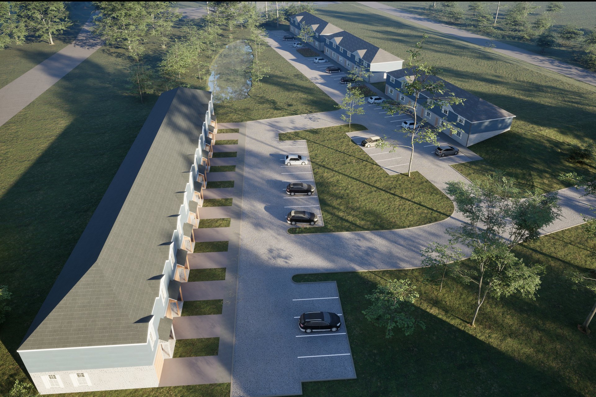
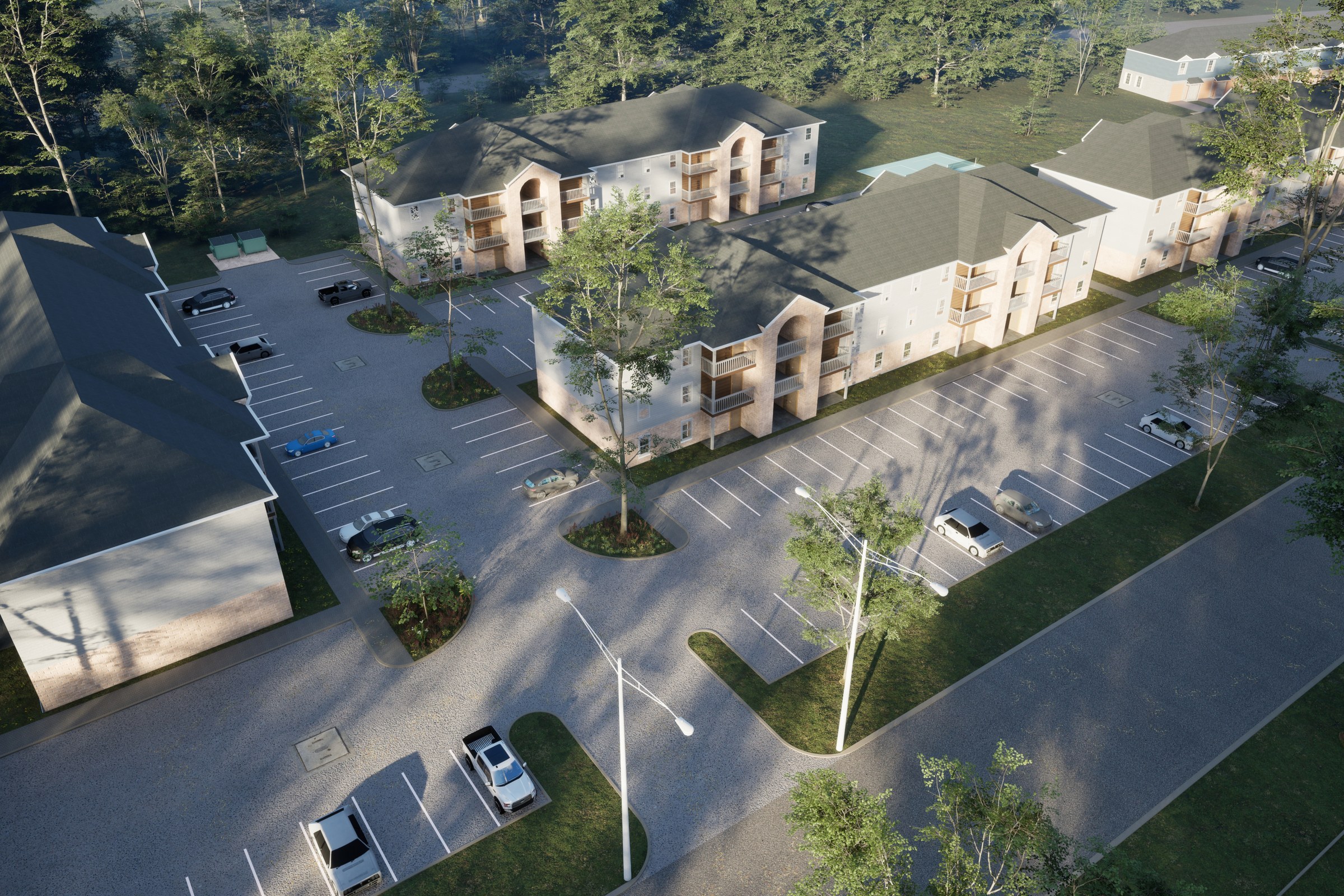
Aerial drone render of the central cluster of the RG apartment community featuring a three-story stucco apartment building with arched balcony openings and warm wood accents, flanked by two-story pitched-roof buildings, shared parking court, street lamps, and surrounding trees.
Client
Crestline Development
Industry
Aerial Masterplan
Objective
Traditional Residential Community Visualization
Deliverables
Photoreal aerial masterplan renders, multiple viewpoints, marketing-ready output
Overview
The Rg Garden Apartment Community is a residential cluster developed by Crestline Development in Jackson Hole, Wyoming. Our brief, delivered in 2024, centered on a single aerial drone render showing the project’s central cluster from elevation. One frame had to do the work of a site model, a marketing piece, and a planning visualization at once.
The cluster pairs a three-story stucco apartment building with arched balcony openings and warm wood accents, flanked by two-story pitched-roof structures arranged around a shared parking court. Street lamps, mature trees, and the surrounding terrain ground the buildings in their setting. The image had to read as a place, not a diagram.
For a Jackson Hole project, that grounding matters. Buyers and approval boards expect architecture to belong. A render that floats buildings on a generic green carpet undermines the whole package. The aerial frame was the project’s primary identity asset, and it needed to perform across stakeholder reviews, brochure spreads, and web hero placements without retouching.
What does an aerial masterplan brief actually demand?
Most aerial frames look the same because most teams treat them the same way. They drop massing into a generic environment, light it at noon, and ship. The result reads as a planning document, not a place. For a project anchored in a specific Wyoming setting, that approach is a non-starter.
The brief here held three things in tension:
- Architectural legibility from significant camera elevation
- Material truth on stucco, wood accents, and roof tile at distance
- A site that reads as Jackson Hole, not as anywhere
Reconciling those three is where most aerial briefs quietly fail.
What made this hard
Aerial masterplan work has a specific failure mode: detail collapses at altitude. Read at 1:1, a render looks crisp. Compressed to a brochure column or a planning submission tile, the same image flattens into shapes. Holding architectural character at scale is the entire game.
Three constraints shaped the production:
- The cluster mixes typologies, three-story stucco against two-story pitched
- Materials had to read at distance, especially PBR materials on stucco and wood
- The shared parking court anchors circulation but cannot dominate the frame
A fourth constraint sat behind those. The render had to survive both back-lit web display and printed hoarding without losing midtone information.
How we approached it
The production split into four phases. Each phase had a single deliverable and a single failure mode we were guarding against.
1. View planning and camera placement
Aerial frames live or die on lens choice and altitude. Too high and the buildings become roofs. Too low and the masterplan reads as massing without context. We tested camera positions iteratively against the design team’s circulation diagram, settling on an angle that read the central cluster’s hierarchy without flattening the parking court.
The right aerial camera shows the architecture twice: once as form, once as community.
2. Source file review and asset preparation
Before lighting, we audited the geometry. Loose normals, missing material assignments, and inconsistent UV scales all surface at altitude as visual noise. We rebuilt the stucco walls with proper displacement mapping on the arched balcony openings, made sure roof geometry held up under ray-traced reflections, and standardized tree assets to a Jackson Hole palette of conifers and aspens.
3. Lighting and atmosphere
We selected a late-afternoon light. Mid-morning would have given clarity but no warmth. Sunset would have flattered the stucco but lost the trees. Our HDRI lighting setup carried the sky and bounce, while a directional sun key established the shadow rake across the parking court. Ambient occlusion was tuned conservatively to avoid the over-baked look common in masterplan renders.
4. Material pass and final render
The final pass focused on material truth. Stucco at distance can read as plastic if the bump scale is wrong. Wood accents go orange in the wrong light. We dialled material response to read accurately at the publication crops the development team had specified, then rendered at print resolution with extra headroom for cropping.
Results
The aerial frame became the project’s lead identity image. The development team used it across web, print, and on-site graphics.
| Type | Quantity | Notes |
|---|---|---|
| Aerial masterplan render | 1 | Central cluster, print-resolution master |
| Crop variants | Multiple | Web hero, brochure spread, hoarding |
| Render passes | Multiple | Beauty, AO, shadow, depth |
The single frame replaced what a less considered package would have needed three or four images to communicate. Stakeholder reviews resolved on first pass. The image carried into pre-sales material without retouching, which is the operative test for a master image.
For the architect, the frame protected the design intent at scale. For the development team, it gave a single asset they could deploy across pre-sales channels without commissioning variants. For marketing, it held its midtones in print without auxiliary correction.
That last point matters more than it sounds. A master image that needs colour-correction for every new substrate is not a master image. It is a starting point. The brief required the former, and the production decisions, particularly around ambient occlusion restraint and material response tuning, were what delivered it.
Key takeaways
-
One considered aerial outperforms three competent ones. A correctly planned camera, lit and surfaced for the actual deliverable, replaces a stack of generic frames.
-
Material truth at distance is a render decision, not a geometry decision. Stucco, wood, and roof tile only read accurately when the response is tuned for the crop the image will live at.
-
Site grounding is non-optional for location-specific projects. Jackson Hole reads as Jackson Hole because of conifer and aspen palette choices, not because of a label on the file.
Working on a project that needs compelling visuals? Tell us about your project or explore our full portfolio.
Project Gallery