Woodland Skatepark Facility — mixed-use 3D rendering by Praxis Studio
Mixed-Use

Woodland Skatepark Facility

Contemporary Site Plan Visualization

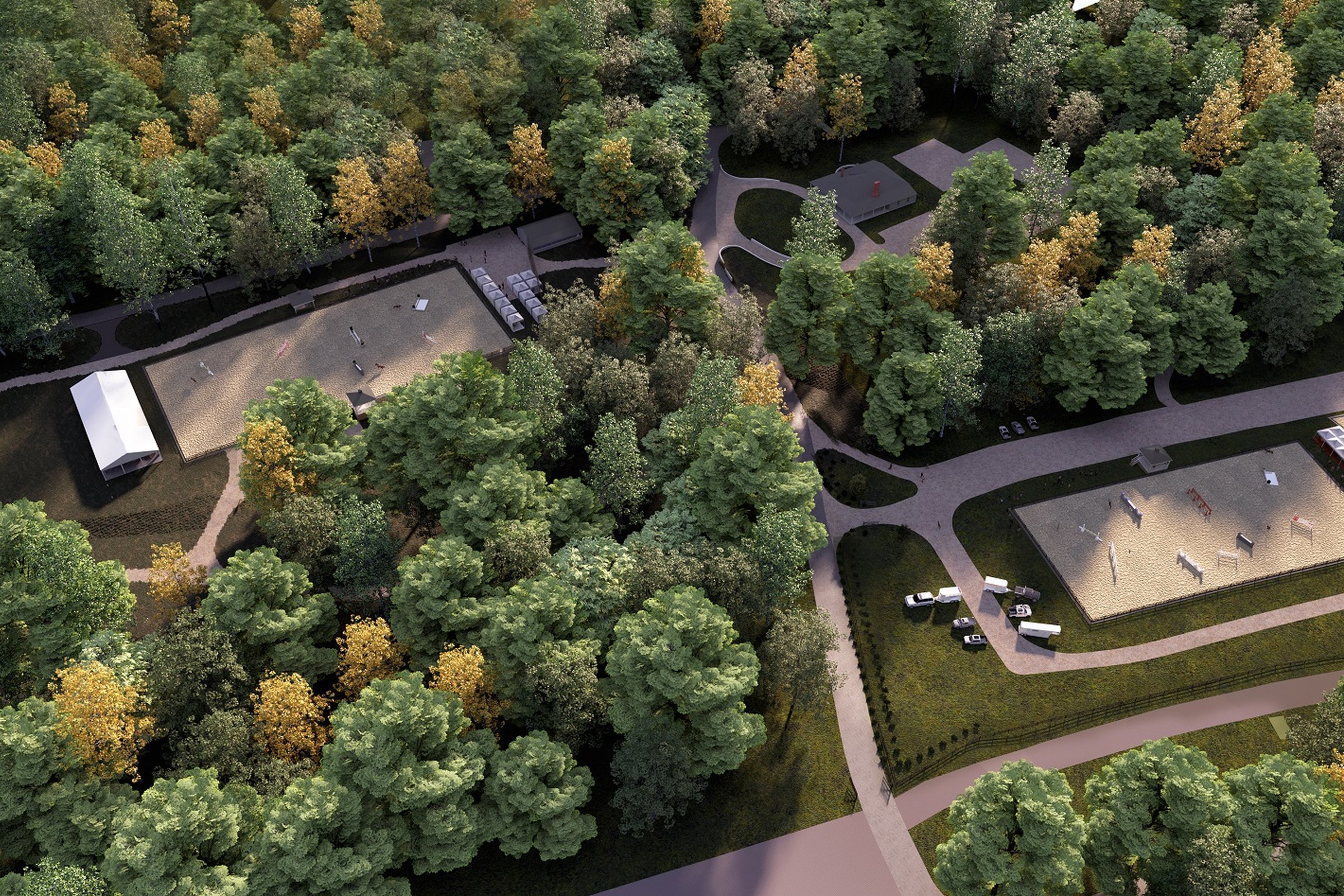
Aerial 3D rendering of the Woodland Skatepark facility, highlighting concrete ramps, landscaped areas, and integrated seating for community use.

Project Overview

Woodland Skatepark Facility was a quick-turn engagement. The real estate developer had a design they were proud of and needed it visualized — no extras, just one precise, photorealistic render.

Dusk aerial render of a woodland recreational facility featuring a concrete skatepark with ramps and bowls, adjacent parking areas, a small utility building, winding access roads, and dense autumnal forest canopy surrounding the entire site.

The Result

Delivered within 1-2 weeks, the render slotted straight into the real estate developer’s pitch deck and has been their lead visual for the project.

Working on something similar? Let’s talk about your project — or browse more of our work.

Frequently Asked Questions

What aerial rendering technique was used to visualize the Woodland Skatepark Facility master plan?

This Woodland Skatepark Facility visualization was created using precision 3D modeling with a drone-perspective camera angle that captures the full site layout at true-to-scale proportions. The render shows aerial 3d rendering of the woodland skatepark facility, highlighting concrete ramps. Every building footprint, road alignment, and landscape element is modeled to ensure the aerial perspective reads accurately for planning and approvals.

How do real estate developers use aerial master plan visualizations like this mixed-use project?

Real Estate Developer professionals present aerial masterplan renders to investors, planning boards, and municipal authorities to communicate the full scope of mixed-use developments. The bird's-eye perspective is especially effective for conveying density, green space allocation, infrastructure layout, and spatial relationships between building clusters in a single image — critical for projects in markets like Tucson, AZ.

What is the typical turnaround time for an aerial masterplan render of Woodland Skatepark Facility?

For a project of this scope, we typically deliver polished final renders within 1-2 weeks after receiving complete site plans and elevation drawings. The timeline accounts for precise 3D modeling of every building, road, and landscape element visible from the aerial vantage point. Rush delivery is available for time-sensitive entitlement deadlines.

What materials and details are captured in the Woodland Skatepark Facility aerial visualization?

Key materials visible in this render include wood, concrete, render. Every element is modeled at a level of detail that remains legible from the aerial camera height while maintaining photorealistic quality across the full site boundary.

What makes aerial masterplan renders different from standard exterior visualizations for mixed-use projects?

Unlike eye-level renders that highlight facade character, aerial masterplans communicate the entire site strategy — parking ratios, building setbacks, open space distribution, and circulation flow — making them the preferred format for planning approvals and site feasibility reviews. For mixed-use projects in Tucson, AZ, this bird's-eye vantage is uniquely suited to demonstrating how a development integrates with its surrounding context.

Like what you see?

Let's create something extraordinary for your next project.