Urban Mixed Use District
Contemporary Urban District Visualization
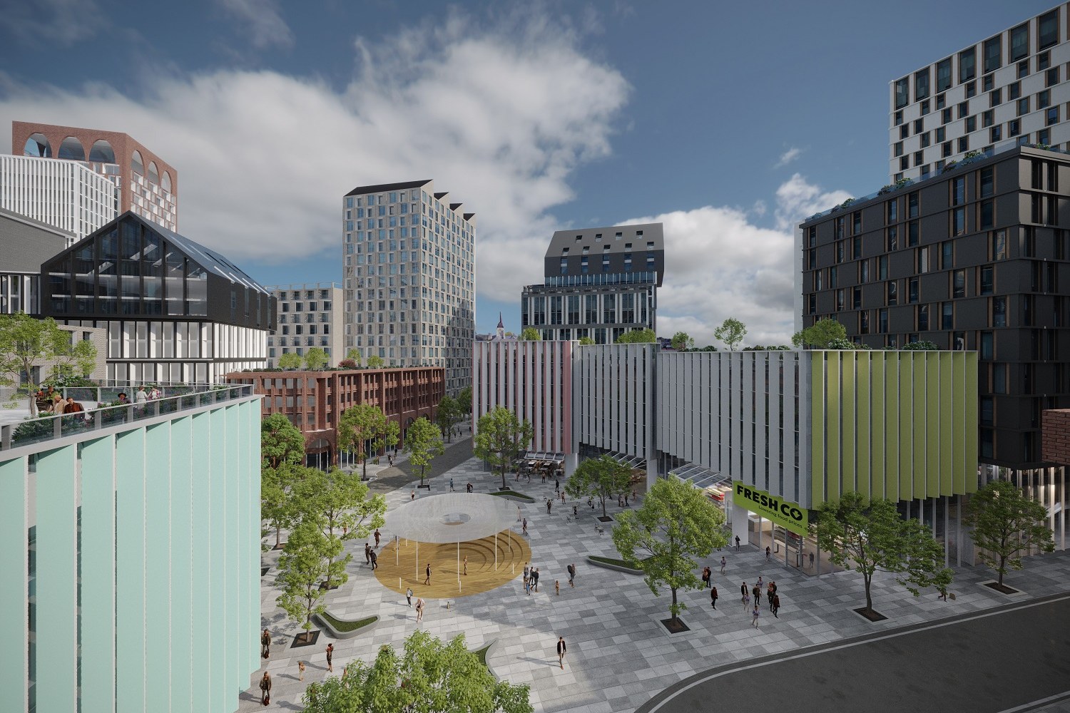
Elevated aerial render of a vibrant mixed-use urban district with multiple mid-rise and high-rise buildings in varied architectural styles, a central public plaza with a gold sculptural art installation, pedestrian promenade lined with trees, FreshCo grocery store at ground level, and diverse facade treatments including mint glass, brick, dark cladding, and colorful vertical fins.
Project Overview
Urban Mixed Use District was a quick-turn engagement. The urban planning firm had a design they were proud of and needed it visualized — no extras, just one precise, photorealistic render.
Elevated aerial render of a vibrant mixed-use urban district with multiple mid-rise and high-rise buildings in varied architectural styles, a central public plaza with a gold sculptural art installation, pedestrian promenade lined with trees, FreshCo grocery store at ground level, and diverse facade treatments including mint glass, brick, dark cladding, and colorful vertical fins.
The Result
The image shipped on schedule and has been the go-to visual for this project ever since — presentations, planning submissions, social media, the lot.
Working on something similar? Let’s talk about your project — or browse more of our work.


