Tropical Townhouse Cluster
Contemporary Residential Community Visualization
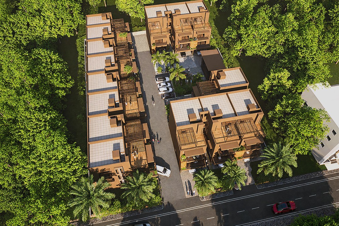
Aerial 3D rendering of a tropical townhouse cluster with warm timber cladding, flat roofs, and lush greenery surrounding the L-shaped courtyard layout.
For the aerial masterplan of the tropical townhouse cluster, our client sought a comprehensive visualization that would encapsulate the essence of their innovative residential development. They needed an engaging representation that would not only showcase the architectural design but also highlight the surrounding landscape and community features. This project was crucial for securing planning approvals and attracting potential investors, as the client aimed to convey a clear vision of their ambitious project.
Our approach to this rendering was centered on creating a vibrant and immersive experience. We meticulously crafted the aerial view to emphasize the harmonious integration of the townhouses with the lush tropical environment. By incorporating elements such as green spaces, pathways, and communal areas, we aimed to illustrate the lifestyle that future residents could expect. Our team utilized advanced techniques to ensure that the rendering was not just visually appealing but also functionally informative, providing a clear understanding of the layout and design intent.
In terms of technical execution, we employed industry-leading software, including 3ds Max and V-Ray, to achieve photorealistic results. Our choice of materials was deliberate; we selected textures that reflected the natural surroundings, such as warm wood finishes and stone accents, to enhance the authenticity of the design. We paid special attention to lighting, using a combination of natural sunlight and ambient lighting to create a welcoming atmosphere that highlighted the architectural features.
The final result was a stunning aerial visualization that exceeded our client’s expectations. It played a pivotal role in their planning application, helping to secure the necessary approvals by clearly communicating the project’s vision to stakeholders. Additionally, the high-quality imagery proved invaluable in marketing efforts, effectively captivating potential investors and buyers, ultimately contributing to the project’s success.
Project Overview
For Tropical Townhouse Cluster, the goal was distilled to its simplest form: produce one render so convincing that it could stand in for the finished building in every pitch deck and planning packet.
Birds-eye aerial render of a compact tropical townhouse development with warm timber cladding and flat/terrace roofs, arranged in an L-shaped courtyard layout with palm trees, a central shared driveway, and dense lush green forest surrounding the site on all sides.
The Result
We delivered the finished image within 1-2 weeks. It’s since been used across the project’s marketing materials, from digital listings to printed collateral.
Thinking about visualization for your next project? Reach out — we respond within 24 hours. Or keep exploring.