Suburban Townhouse Infill
Traditional Residential Community Visualization
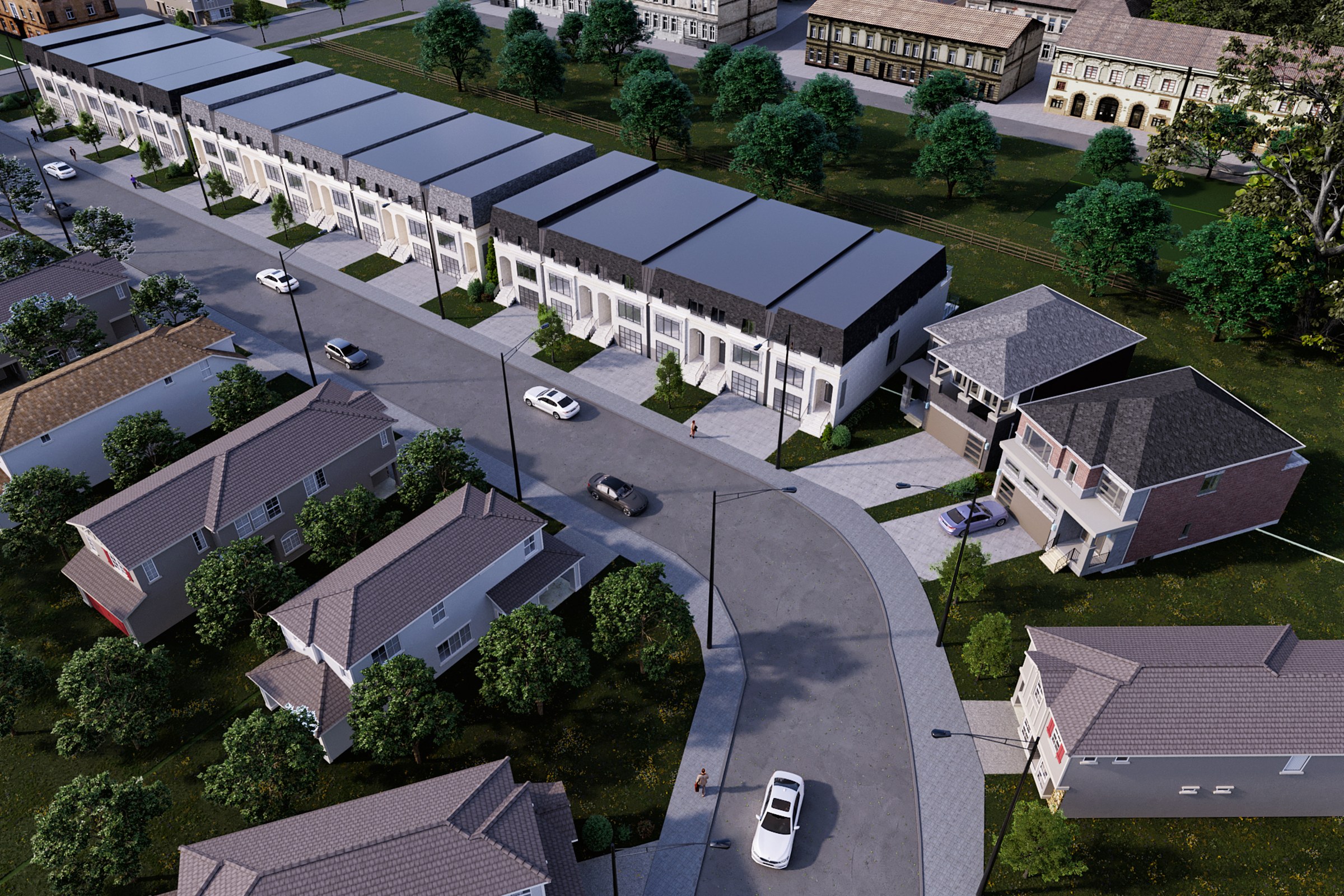
Overcast aerial render of a suburban infill townhouse development with a central row of two-story attached townhomes featuring pitched grey roofs, flanked by existing detached houses, a curved cul-de-sac road, parking areas, and mature trees.
In our recent project, we collaborated with a visionary architect to create a comprehensive aerial masterplan for a suburban townhouse infill development. The client sought to visualize the potential of the site, aiming to secure planning approval and attract investors. They needed a compelling representation that would not only highlight the architectural features but also showcase the integration of the new development within the existing community.
Our approach to this rendering was centered on capturing the essence of the suburban environment while emphasizing the innovative design of the townhouses. We meticulously crafted a detailed aerial view that illustrated the layout, landscaping, and surrounding amenities. By incorporating elements such as green spaces and pedestrian pathways, we ensured that the design resonated with the community’s lifestyle, making it a desirable addition to the neighborhood.
To achieve this, we utilized advanced software tools, including 3ds Max and V-Ray, which allowed us to create photorealistic visuals with stunning detail. We focused on natural lighting to enhance the overall ambiance, employing a time-of-day simulation that showcased the project in the best possible light. The materials were carefully selected to reflect the intended finishes, from the warm tones of the brick facades to the lush greenery that surrounded the townhouses.
The final result was a striking aerial masterplan that not only met but exceeded our client’s expectations. The high-quality rendering played a crucial role in their planning application, helping them secure the necessary approvals with ease. Additionally, it served as a powerful marketing tool, effectively communicating the vision to potential investors and stakeholders, ultimately leading to a successful pitch that garnered significant interest in the project.
Project Overview
Suburban Townhouse Infill was a quick-turn engagement. The real estate developer had a design they were proud of and needed it visualized — no extras, just one precise, photorealistic render.
Overcast aerial render of a suburban infill townhouse development with a central row of two-story attached townhomes featuring pitched grey roofs, flanked by existing detached houses, a curved cul-de-sac road, parking areas, and mature trees.
The Result
Delivered within 1-2 weeks, the render slotted straight into the real estate developer’s pitch deck and has been their lead visual for the project.
Got a project that needs this kind of visual clarity? Get in touch or see more examples.


