Solar Powered Tropical Township
Modern Township Visualization
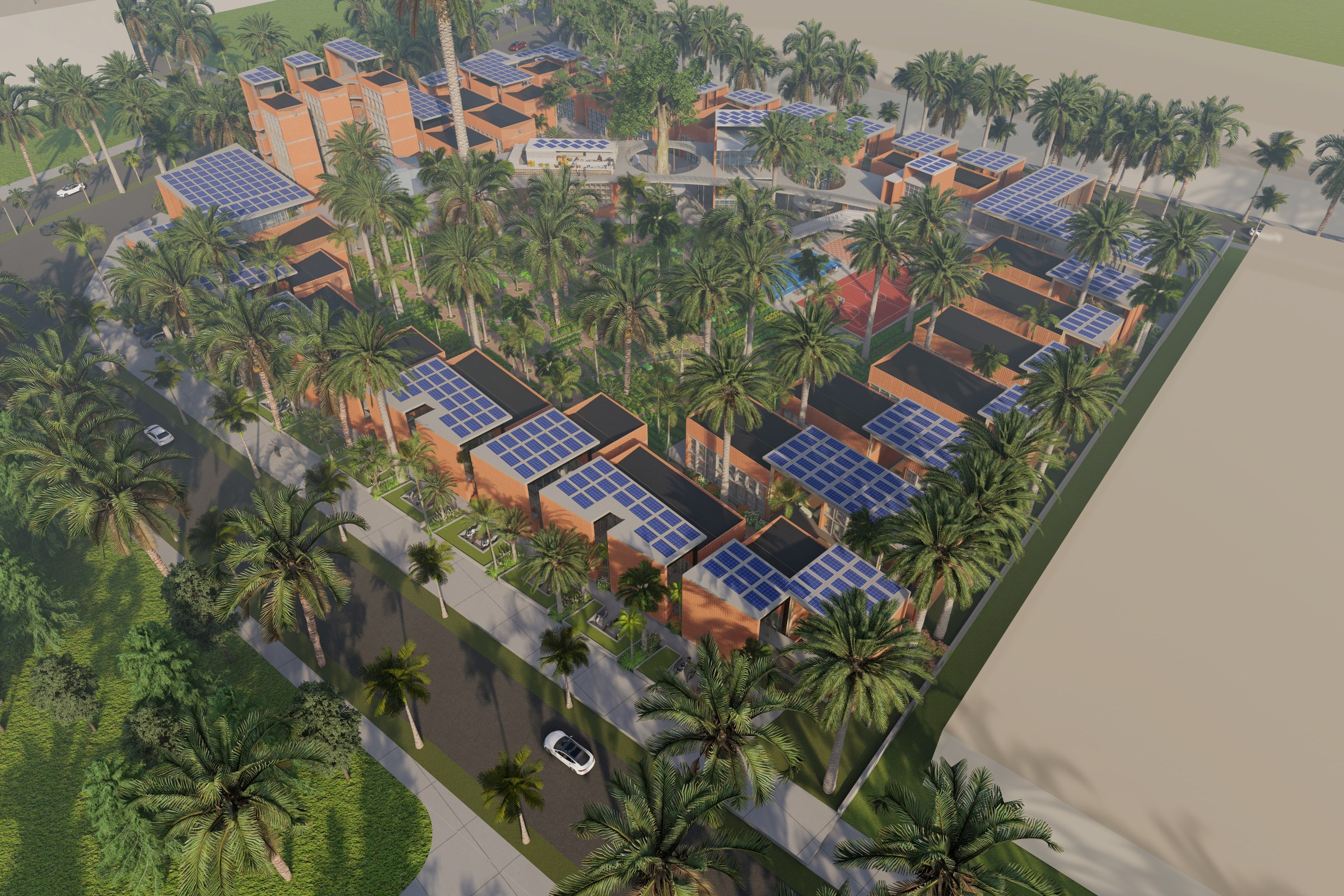
Aerial render of a tropical residential township featuring terracotta and modern buildings with extensive solar panel arrays on roofs, surrounded by palm trees and waterfront edge.
In our latest project, we had the exciting opportunity to collaborate with a visionary client who sought to create a solar-powered tropical township. The client needed a comprehensive aerial masterplan visualization that would not only showcase the innovative design but also highlight the sustainable features of the development. This project was crucial for securing planning approvals and attracting potential investors who are increasingly focused on eco-friendly developments.
Our approach to this rendering was centered around capturing the essence of tropical living while emphasizing the sustainable aspects of the township. We meticulously crafted a vibrant landscape that harmonizes with the natural surroundings, incorporating lush greenery and solar panels seamlessly into the design. By utilizing advanced 3D modeling techniques, we were able to create a dynamic aerial view that showcases the layout of the township, including residential areas, communal spaces, and eco-friendly amenities.
For this project, we employed industry-leading software such as Autodesk 3ds Max and V-Ray to achieve photorealistic results. Our team paid special attention to lighting, ensuring that the warm, tropical sunlight accentuated the textures of the materials used in the design. We selected a palette of sustainable materials that reflect the township’s commitment to environmental responsibility, including natural stone and eco-friendly finishes. The final render was enhanced with realistic shadows and reflections, creating an immersive experience for viewers.
The outcome of this project was a stunning aerial visualization that not only met but exceeded our client’s expectations. The high-quality renderings played a pivotal role in securing planning approval from local authorities and served as a powerful marketing tool during investor pitches. By effectively communicating the vision of a sustainable, solar-powered community, we helped our client attract interest and investment, paving the way for a successful development.
Project Overview
The team behind Solar Powered Tropical Township came to us with a clear ask — a single, definitive render that would capture the essence of this master plan project in Oxford, UK.
Aerial render of a tropical residential township featuring terracotta and modern buildings with extensive solar panel arrays on roofs, surrounded by palm trees and waterfront edge.
The Result
The final render was delivered within 1-2 weeks — on time, on brief, ready for immediate use in the urban planning firm’s marketing and approval workflow.
Working on something similar? Let’s talk about your project — or browse more of our work.


