Roadside Highrise Apartment
Modern Residential Tower Visualization
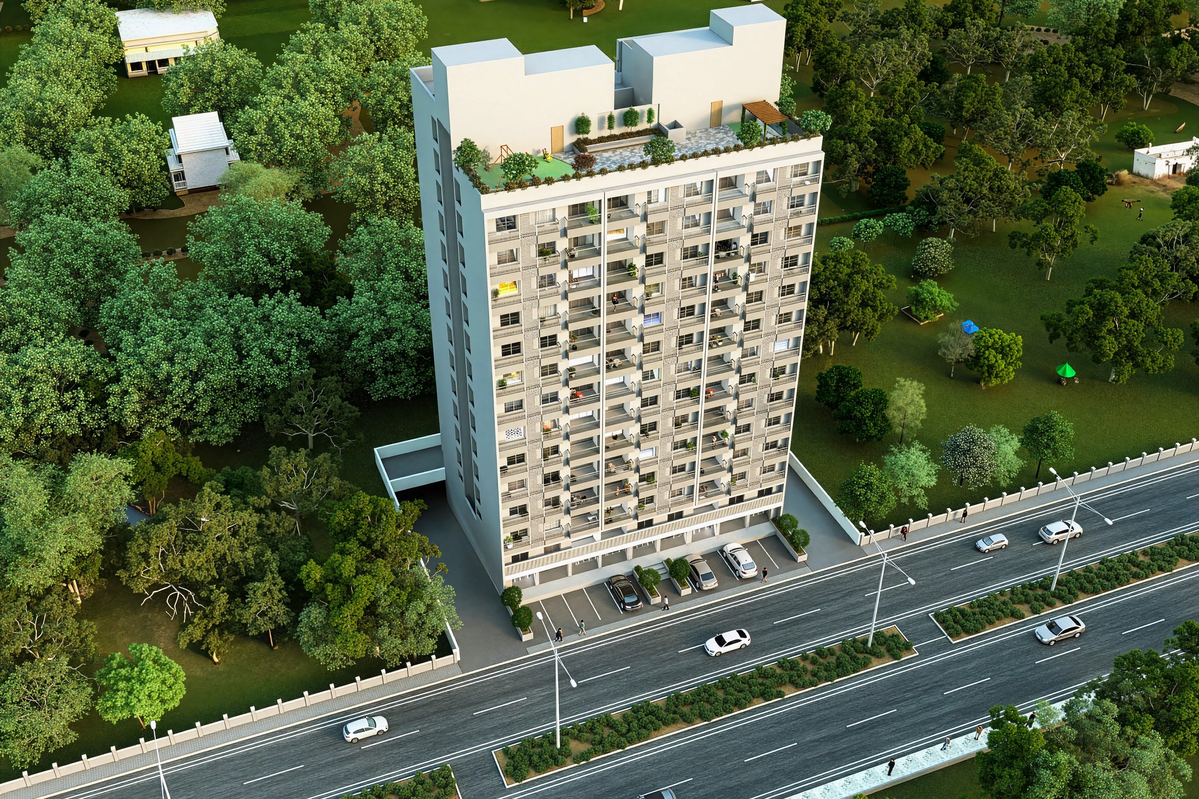
Aerial render of a single high-rise residential apartment tower (approximately 14-15 stories) with beige and grey facade, rooftop mechanical units, balconies on each floor, set along a main road with lush green surrounding parkland and low-rise structures behind.
Project Overview
A master plan project in Atlanta, GA, Roadside Highrise Apartment came to us at the stage where the design was locked and the client needed one image — the definitive view — for their launch materials.
Aerial render of a single high-rise residential apartment tower (approximately 14-15 stories) with beige and grey facade, rooftop mechanical units, balconies on each floor, set along a main road with lush green surrounding parkland and low-rise structures behind.
The Result
We delivered the finished image within 1-2 weeks. It’s since been used across the project’s marketing materials, from digital listings to printed collateral.
Working on something similar? Let’s talk about your project — or browse more of our work.