Roadside Commercial Plaza
Contemporary Site Plan Visualization
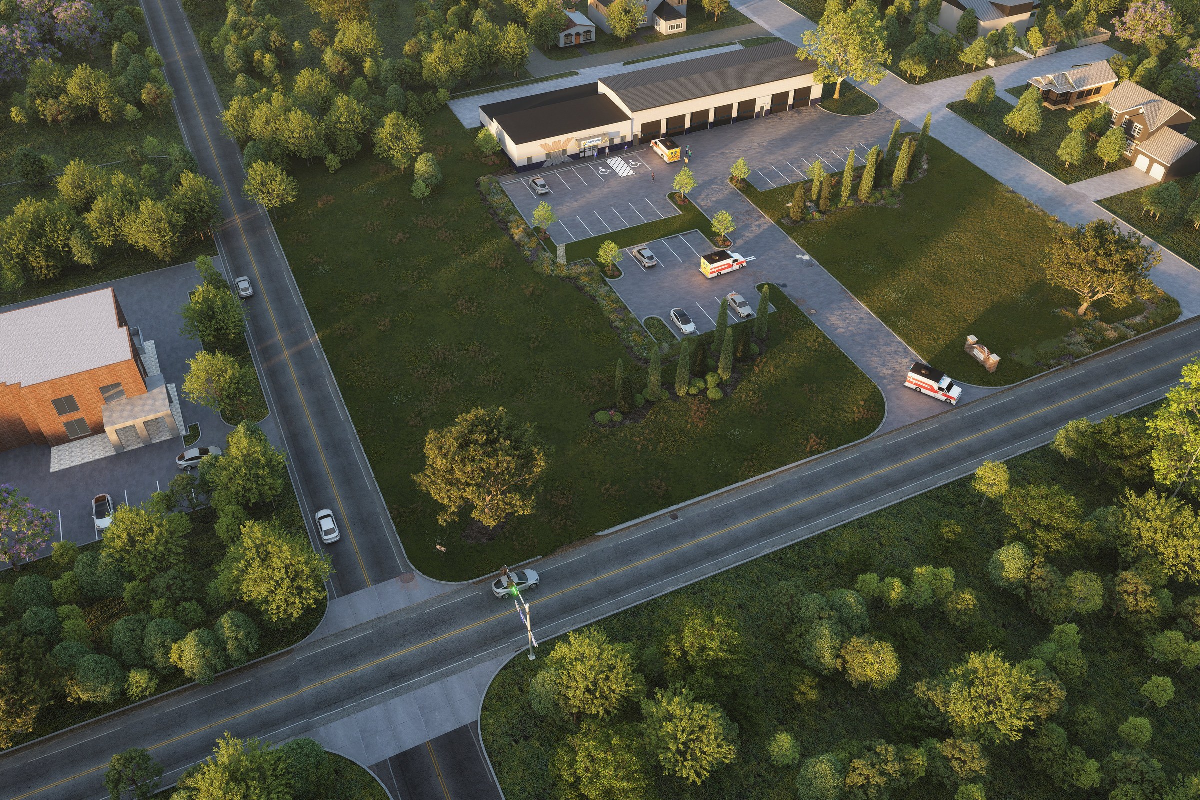
Dusk aerial render of a low-rise commercial building with covered colonnade, parking lot, and surrounding lush green landscape at a road intersection.
For our project titled “Aerial Masterplan - Roadside Commercial Plaza,” our client sought a comprehensive visualization that would effectively showcase their ambitious commercial development. The goal was to create a striking aerial rendering that not only highlighted the plaza’s unique design but also illustrated its strategic location and accessibility to potential investors and stakeholders. With the increasing competition in the commercial real estate market, our client needed a compelling visual tool to facilitate planning approvals and attract future tenants.
Our approach to this rendering was centered around capturing the essence of the plaza while emphasizing its integration with the surrounding environment. We conducted thorough research on the site’s context, including traffic patterns and nearby amenities, to ensure that our visualization reflected the plaza’s potential impact on the community. By incorporating dynamic elements such as people, vehicles, and greenery, we created a vibrant scene that conveyed a sense of activity and engagement, making the plaza feel inviting and lively.
To achieve the desired photorealism, we utilized advanced software such as Autodesk 3ds Max and V-Ray for rendering, ensuring that every detail was meticulously crafted. We paid special attention to lighting, employing a combination of natural sunlight and artificial sources to create a warm and welcoming atmosphere. The materials used in the rendering were selected to reflect the high-quality finishes intended for the plaza, enhancing the overall realism of the visualization.
The final result was a stunning aerial rendering that exceeded our client’s expectations. It played a crucial role in securing planning approval and was instrumental during investor pitches, effectively communicating the vision of the project. Our work not only helped in marketing the plaza but also positioned our client as a forward-thinking developer in the competitive landscape of commercial real estate.
Project Overview
For Roadside Commercial Plaza, the goal was distilled to its simplest form: produce one render so convincing that it could stand in for the finished building in every pitch deck and planning packet.
Dusk aerial render of a low-rise commercial building with covered colonnade, parking lot, and surrounding lush green landscape at a road intersection.
The Result
The image shipped on schedule and has been the go-to visual for this project ever since — presentations, planning submissions, social media, the lot.
If this is the kind of quality you’re after, start a conversation with us. Or explore the full portfolio.


