Luxury Twin Tower Development
Traditional Commercial Development Visualization
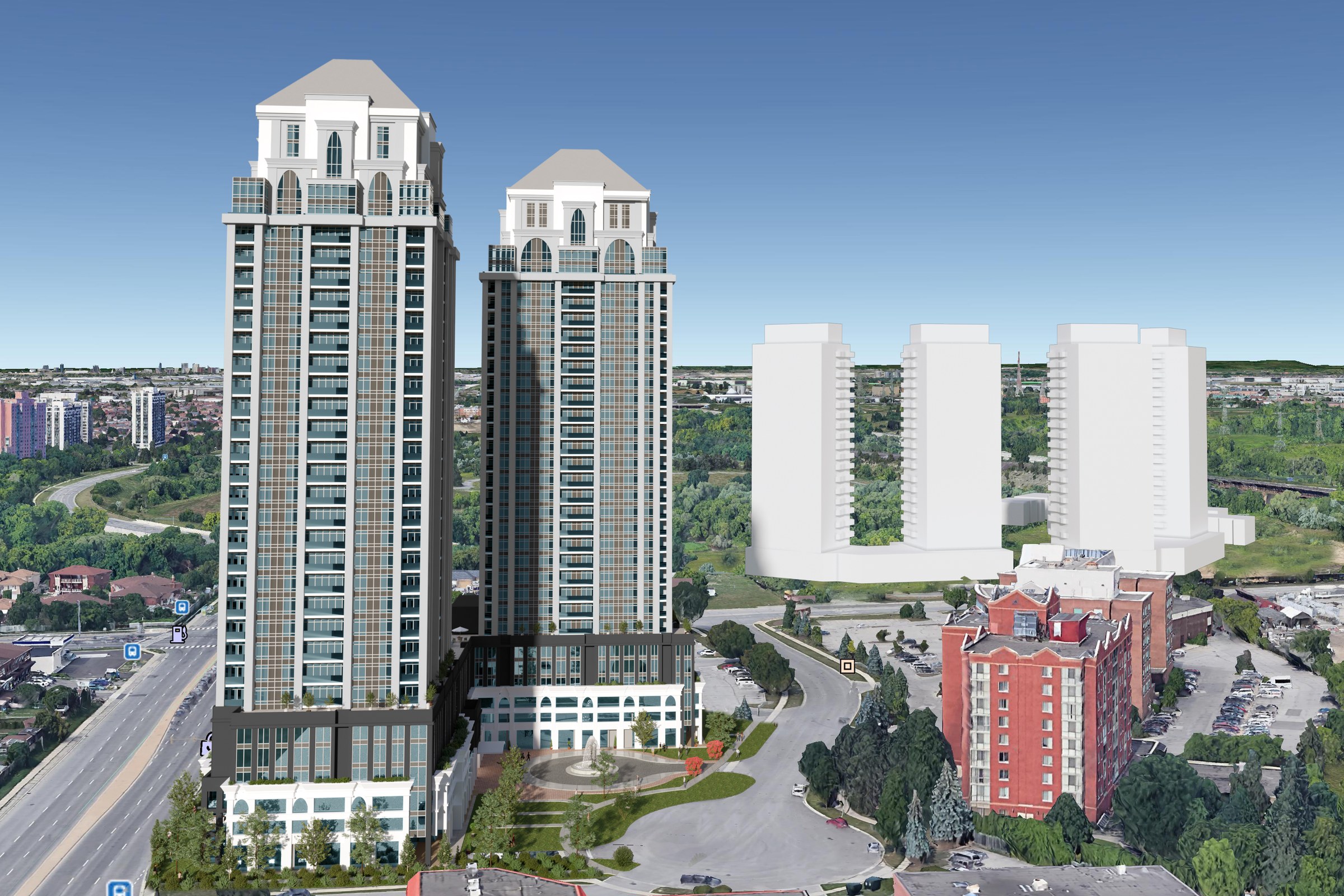
Aerial render of two ornate high-rise residential towers with classical crown elements, alongside two white massing models, set against a suburban cityscape with highways.
For our latest project, the luxury twin tower development, our client sought a comprehensive aerial masterplan visualization that would effectively showcase their ambitious vision. They needed a striking representation to attract potential investors and secure planning approval, ensuring that every detail of the development was highlighted in a way that conveyed its grandeur and sophistication.
Our approach to this rendering was rooted in a deep understanding of the project’s context and the client’s aspirations. We meticulously crafted the aerial view to not only depict the twin towers but also to integrate the surrounding landscape, emphasizing the development’s connectivity and its luxurious amenities. By incorporating elements such as green spaces, pedestrian pathways, and nearby infrastructure, we created a holistic view that told a compelling story about the lifestyle the towers would offer.
To achieve this stunning visualization, we utilized advanced software tools, including 3ds Max and V-Ray, which allowed us to render photorealistic images with exceptional detail. We paid special attention to lighting, simulating natural sunlight to enhance the architectural features and create inviting shadows that added depth to the scene. The materials were carefully selected to reflect the luxury aspect of the towers, with high-quality textures for glass, concrete, and landscaping that brought the design to life.
The final result was a breathtaking aerial rendering that not only met but exceeded our client’s expectations. This visualization played a pivotal role in their marketing strategy, helping them secure planning approval and successfully pitch to investors. The stunning imagery effectively communicated the essence of the luxury twin tower development, positioning it as a premier investment opportunity in the competitive real estate market.
Project Overview
For Luxury Twin Tower Development, the goal was distilled to its simplest form: produce one render so convincing that it could stand in for the finished building in every pitch deck and planning packet.
Aerial render of two ornate high-rise residential towers with classical crown elements, alongside two white massing models, set against a suburban cityscape with highways.
The Result
Turnaround was 1-2 weeks. The render now serves as the primary visual for the project — anchoring everything from the website header to the investor summary.
Working on something similar? Let’s talk about your project — or browse more of our work.


