Ils Industrial Warehouse
Modern Site Plan Visualization
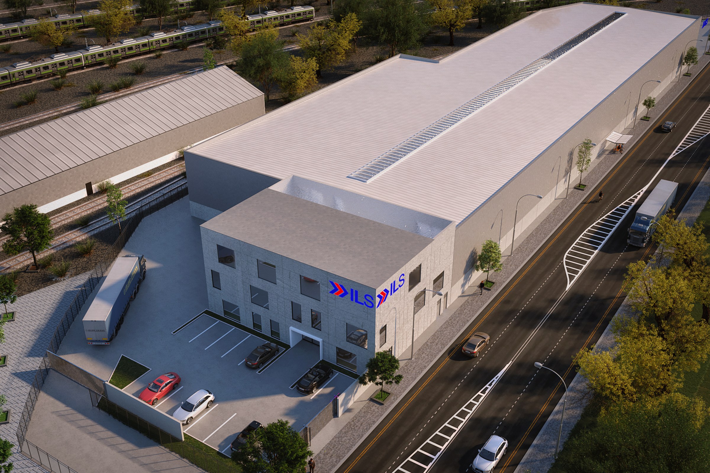
Aerial render of a large industrial/warehouse building with 'ILS' signage on the facade, loading dock area, adjacent railway line, and surrounding desert vegetation.
In our recent project for the ILS Industrial Warehouse, our client approached us with a clear vision: they needed a comprehensive aerial masterplan rendering to showcase their new industrial facility. The goal was to create a compelling visual that would not only assist in securing planning approvals but also serve as a powerful marketing tool to attract potential investors and tenants. Understanding the importance of this project, we set out to deliver a rendering that would exceed their expectations.
Our approach to this aerial masterplan was rooted in meticulous attention to detail and a deep understanding of the industrial landscape. We began by conducting thorough research on the site and its surroundings, ensuring that our rendering accurately reflected the context of the location. By incorporating realistic elements such as surrounding infrastructure, landscaping, and even potential traffic flow, we created a holistic view that highlighted the warehouse’s strategic advantages. This unique perspective allowed us to present the project in a way that emphasized its functionality and aesthetic appeal.
For the technical execution, we utilized advanced software such as Autodesk 3ds Max and V-Ray, which enabled us to achieve photorealistic lighting and material effects. We carefully crafted the lighting to simulate natural sunlight, enhancing the textures of the building materials and the surrounding environment. The result was a vibrant and inviting visual that captured the essence of the industrial design while ensuring clarity and precision in every detail.
The final rendering proved to be a game-changer for our client. It not only facilitated a smooth planning approval process but also became a key asset in their marketing strategy. The striking visuals attracted significant interest from potential investors, ultimately leading to successful partnerships and a promising future for the ILS Industrial Warehouse project. We take pride in knowing that our work played a crucial role in bringing our client’s vision to life.
Project Overview
We picked up Ils Industrial Warehouse as a focused engagement: one hero image for a master plan project in Miami, FL. Short timeline, high bar for quality.
Aerial render of a large industrial/warehouse building with ‘ILS’ signage on the facade, loading dock area, adjacent railway line, and surrounding desert vegetation.
The Result
The final render was delivered within 1-2 weeks — on time, on brief, ready for immediate use in the master plan developer’s marketing and approval workflow.
Have a project in mind? Drop us a brief and we’ll get back to you with a quote within a day. Or see what else we’ve done.


