Hilltop Commercial Building
Modern Site Plan Visualization
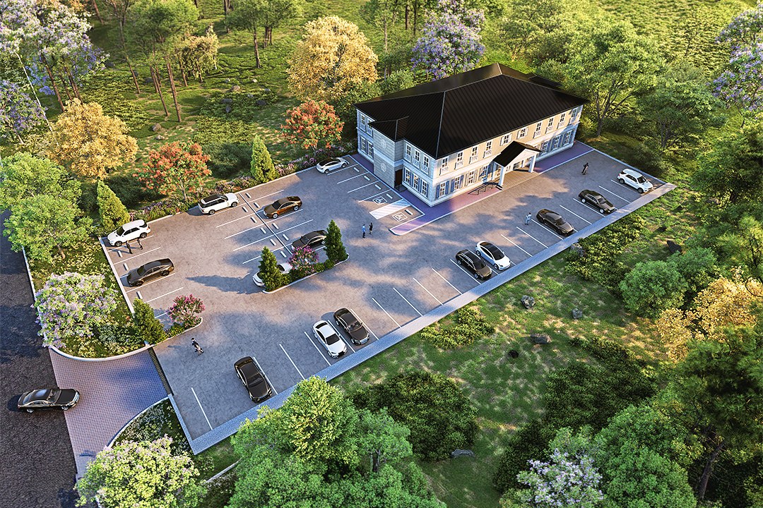
Aerial 3D rendering of a modern commercial building with a grey and white facade on a hilltop, surrounded by forest and a visible water body.
In our recent project, the aerial masterplan for a hilltop commercial building, our client sought a striking visualization that would effectively communicate their vision to stakeholders and potential investors. The project required a comprehensive representation of the site’s unique topography and the proposed building’s integration into the landscape, ensuring that it would stand out in a competitive market. Our client aimed to secure planning approval while also generating excitement for future tenants and investors.
To achieve this, we adopted a meticulous approach that emphasized the harmony between the structure and its surroundings. Our team conducted thorough site analysis and collaborated closely with the client to understand their vision and objectives. We utilized advanced 3D modeling techniques to create a detailed aerial view that showcased not only the building but also the surrounding environment, including landscaping and access routes. This holistic perspective allowed us to highlight the project’s potential impact on the community and its aesthetic appeal.
In terms of technical execution, we employed industry-leading software such as Autodesk 3ds Max and V-Ray to create photorealistic renders. We paid special attention to lighting, utilizing natural sunlight to enhance the building’s features and create inviting shadows that added depth to the scene. The materials were carefully selected to reflect the client’s branding and the intended use of the space, ensuring that every element contributed to a cohesive visual narrative.
The final result was a stunning aerial rendering that not only met but exceeded our client’s expectations. This visualization played a crucial role in securing planning approval and was instrumental in their marketing efforts. It provided a compelling visual tool for investor pitches, showcasing the project’s potential and helping to attract interest from key stakeholders. Our work on this project exemplifies our commitment to delivering high-quality architectural visualizations that drive results for our clients.
Project Overview
Hilltop Commercial Building was a quick-turn engagement. The municipal government had a design they were proud of and needed it visualized — no extras, just one precise, photorealistic render.
Aerial render of a small modern commercial building with grey and white facade situated on a cleared hilltop lot with paved parking, surrounded by dense deciduous forest and a water body or river visible at the bottom edge.
The Result
The final render was delivered within 1-2 weeks — on time, on brief, ready for immediate use in the municipal government’s marketing and approval workflow.
Working on something similar? Let’s talk about your project — or browse more of our work.